
Industrial UAV & Aerial Site Photography
Aerial photography for large industrial sites, facilities, yards, rooflines, access roads and project context.
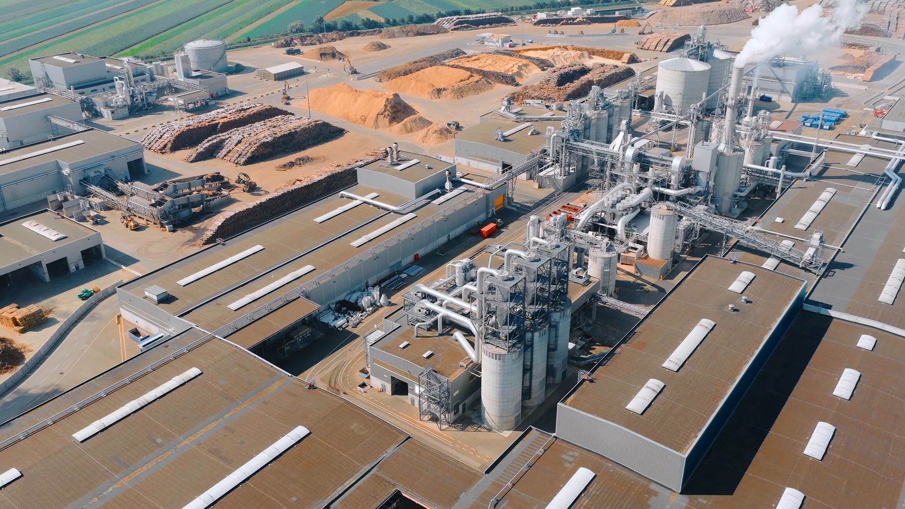
Aerial photography for industrial site context
- Useful for facility overviews, industrial property, site access communication, project updates, roofline context and large worksite marketing.
- Deliverables can include aerial stills, site overview images, roof and yard context photos, progress comparison angles and selected ground photos.
- The service is photography-led, but it can be combined with drone video when a project also needs motion or stakeholder update clips.
Aerial photography for large industrial sites, facilities, yards, rooflines, access roads and project context. If the brief points to a wider industrial photography services sydney need, Lenscast can also advise on industrial photographer sydney and factory & production line photography so the final content set fits the whole worksite story.
Scoped around safety, airspace and permission
- Drone capture may not be suitable for every site, especially around restricted airspace, high-risk operations or poor weather.
- Ground photography can be planned as a backup or companion to aerial photos.
- Sensitive neighbouring properties, signage, vehicles, stock or restricted infrastructure can be considered in the capture plan.
Lenscast industrial photography
Industrial UAV & Aerial Site Photography planned around the site, the brief and the final use
Aerial photography for large industrial sites, facilities, yards, rooflines, access roads and project context. Lenscast plans the image set around the spaces, processes and crops the business needs for web pages, tenders, sales material and internal updates.
Aerial site and access planning
Drone capture may not be suitable for every site, especially around restricted airspace, high-risk operations or poor weather.
UAV stills with ground context where useful
Ground photography can be planned as a backup or companion to aerial photos.
Photos for reports, tenders and web
UAV photography is best used when a team needs practical site context rather than a technical inspection report. It can show how a facility, yard, roofline or project footprint sits in the surrounding area, then connect that aerial view with ground-level detail.
- Industrial UAV & Aerial Site Photography for Sydney industrial and worksite teams
- Image sets planned for websites, capability statements and sales teams
- UAV photography is best used when a team needs practical site context rather than a technical inspection report. It can show how a facility, yard, roofline or project footprint sits in the surrounding area, then connect that aerial view with ground-level detail.
Where UAV photography helps
- Factory and warehouse exterior overviews.
- Yards, access roads, loading areas and site approach images.
- Construction progress, expansion, roofline and milestone photos.
- Aerial context for capability statements, stakeholder updates and sales decks.
Common questions
- Repeatable viewpoints can be planned for progress comparison or recurring stakeholder updates.
- Ground photos can be captured in the same visit to show detail, people and process context.
- Aerial photos can be delivered for web, reports, presentations, tenders and marketing collateral.